Private Satellites and AI Transform Earth Observation
New OECD report warns that democratized satellite data raises dual-use concerns alongside unprecedented monitoring capabilities.
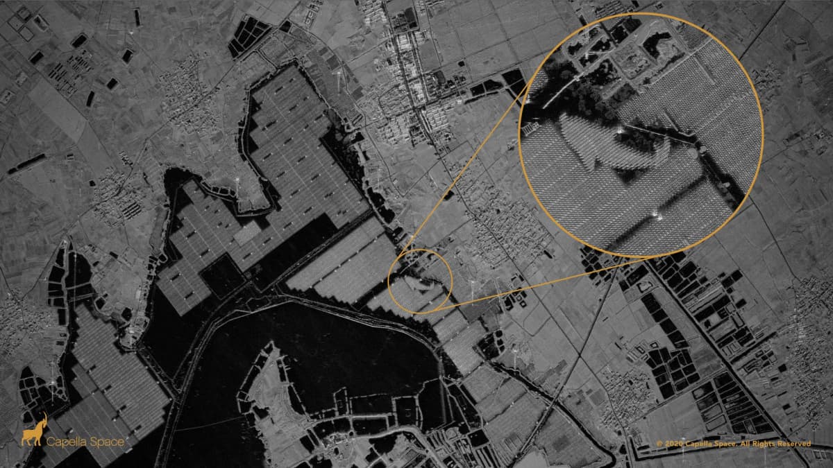
The commercial satellite industry has fundamentally reshaped how humanity monitors Earth, deploying constellations that deliver unprecedented access to high-resolution imagery. But a new report from the Organization for Economic Co-operation and Development warns that advances in optical systems, cloud computing, and artificial intelligence have created a dual-use dilemma: the same satellites tracking illegal fishing can detect military movements.
The OECD analysis, authored by Marit Undseth and Claire Jolly, highlights how technological convergence has democratized satellite data quality and accessibility while introducing fresh risks to national security and privacy. The report also flags a growing threat from fake or misrepresented satellite imagery that could erode trust in remote-sensing data as part of broader digital disinformation campaigns.
Why it matters
Earth observation is no longer a government monopoly. Commercial operators now field entire constellations that deliver real-time intelligence to customers worldwide, forcing policymakers to balance innovation against security concerns. The integration of AI with satellite imagery creates both opportunity and risk: algorithms can spot changes invisible to human analysts, but they also enable mass surveillance and require careful validation to prevent misuse.
Synthetic aperture radar changes the game
Viktor Stoyanov, chief operating officer at UAE-based Space42, told Space.com that the industry has shifted from large general-purpose platforms to constellations of specialized satellites. Space42 operates the Foresight constellation, the region's first sovereign dual-use synthetic aperture radar system, built in partnership with Finland's ICEYE.
SAR satellites image through cloud, dust, and darkness—critical capabilities for consistent monitoring regardless of weather or timing. Stoyanov said the short lifespan of low Earth orbit satellites creates continuous upgrade opportunities, with each replenishment cycle improving resolution, latency, and satellite longevity.
The volume of SAR imagery far exceeds what human analysts can review manually. "Customers responding to a flood, a maritime incident or a supply-chain disruption need an answer in minutes, not a report next week," Stoyanov explained. AI has become the only practical sorting tool, delivering what he calls "decision-grade intelligence within minutes" by comparing new imagery against historical baselines to catch changes that human eyes might miss.
Hyperspectral sensors close the resolution gap
Francis Doumet, CEO of Vancouver-based Metaspectral, pointed to improved spatial resolution in hyperspectral sensors as a major advance. These sensors capture spectral fingerprints of Earth's surface, identifying materials and conditions through their unique light signatures.
Better sensors, high-speed compression, and optical communication links are narrowing the resolution gap, Doumet said. Onboard AI allows satellites to analyze imagery in real time, transmitting alerts or compact intelligence products instead of waiting to download entire hyperspectral data cubes.
Doumet described the Earth observation sector as a hybrid model where governments and allies share requirements and intelligence while commercial operators supply imagery and analytics "at a speed and scale that would be difficult or impossible for a single nation to produce alone." He cited the U.S. Space Force's Tactical Surveillance, Reconnaissance and Tracking program as an example of combining commercial satellite imagery from American companies and allied nations.
Training the next generation
Angie Crews, a principal research associate at the University of Colorado Boulder's Center for National Security Initiatives, emphasized the need to train students beyond single sensors or datasets. The next generation must understand how different sensing technologies work and how to extract meaningful information from large datasets using AI and machine learning, she said.
Crews stressed the importance of critical thinking and awareness of AI limitations. "The underlying physics need to be understood and the results need to be validated so that the students use and interpret the results appropriately," she told Space.com.
The balancing act between securing information for national security purposes and avoiding constraints on private sector innovation remains a central challenge as commercial Earth observation capabilities continue to expand.
These details were first reported by Leonard David at Space.com.
This is an original analysis by the Omega editorial team. Source reporting: AI Watch.
Want systems like this working for your business?
Book a Call